Pillar
OS grid ref:- NY 171 121
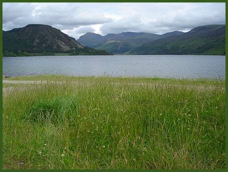
Situated on the Western Lake District fells near remote Ennerdale Water at the head of the Mosedale and Ennerdale valleys, the looming bulk of Pillar, at 892m (2,927 feet) is Cumbria's eleventh highest mountain and forms part of the Mosedale Horseshoe.
Left- Clouds skim the summit of Pillar. Right- Pillar seen across Ennerdale Water
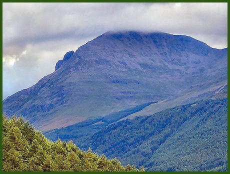
The mountain was first climbed in the 1860's. Its summit commands superb views of the Buttermere and Crummock Valley and beyond. The summit ridge of Pillar is one of the best places to see the 'brocken spectre' when the sun casts your shadow onto the mist in the coves below.
The Pillar High Level Route
Distance - 5 miles (8km)
Ascent - 1,800 ft (550m)
Duration - 3 - 5 hours
*Commencing at the Youth Hostel at Gillerthwaite continue 2 miles along the forest road until reaching the junction at Grid ref:- NY 174 132 Taking the road that climbs up into the forest, turn left at the arrow marked path, which goes steeply up through a gap in the trees.
*After around 100 metres, you will reach a prominent boulder to the left of the path. Ascend upwards on the right hand side of the waterfall, which involves scrambling over loose scree. Keep to the right side of the beck, after passing two cairns, take the left stony path up to the High level route.
*After dropping, the path ascends gently, providing excellent views of Pillar Cove. Cross a straight section of scree and boulders before ascending a further 100m to Robinson's Cairn. The views of Ennerdale from this point are superb.
*The path descends steadily for around 800m, before climbing to a cairn, bearing right along the cliff edge. This part of the walk involves a steep downward scramble to Proud Knott. The path continues around the rim of the Green Cove rising for about 50m, it then drops and climbs steeply again, before becoming a rock strewn switchback, involving some steep rock climbing.
*Join the main path from the Pillar Ridge to descend down into Ennerdale via Black Sail Pass, which passes the cascades on Sail Beck . Continue down through the glacial moraines to the youth hostel at Black Sail Hut
- Obtain a reliable local weather forecast before you set off and plan a route suitable for forecast conditions.
- Check your equipment before leaving, take waterproofs, spare warm clothing, hat and gloves. food and drink, a map, a compass and a survival bag.
- Learn basic mountain skills, particularly navigation.
- If weather conditions turn bad, turn back.
- Don't rely on mobile phones.