Ennerdale Water
OS Grid ref :- NY0815
Remote Ennerdale Water, quiet and solitary, is one of the least developed of the English lakes and has an isolated location on the western verge of Lakeland. It remains a tranquil spot, 'far from the madding crowd' even in summer, mainly due to the fact that no road circles the lake.
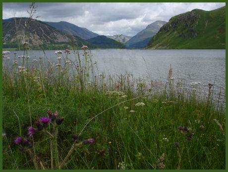
Left- Ennerdale from Kirkland. Right - Ennerdale from the west shore showing Pillar and Steeple in the far distance
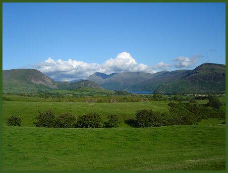
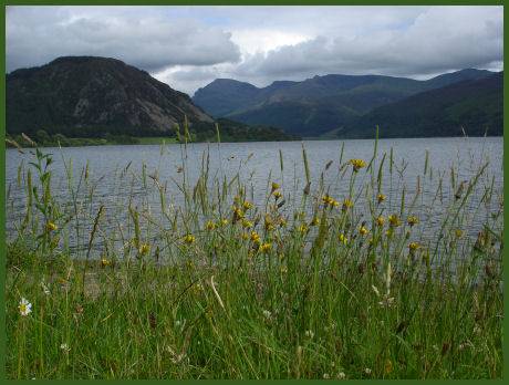
Originally known as 'Broadwater', Ennerdale measures two and a half miles long, three quarters of a mile wide and 45 metres (150 feet) deep. Ennerdale's western end is mountainous and panoramic and is dominated by the rocky bulk of Pillar (892 metres), Haycock (797m), Steeple ( 819m) and Great Scoat Fell (802m). Its eastern end is set in a flatter landscape which looks out over the West Cumbrian plain towards Whitehaven and Workington.
The long Ennerdale Valley was gouged out by glaciers during the Ice Age and has its origins as a stream high beneath the crags of Great Gable. The head of the valley is at the Wind Gap between Green and Great Gables. The lake has been used as a reservoir for over a hundred and thirty years, resulting in the water being extremely pure with little plant life or water fowl inhabiting it. It is owned by United Utilities. The level of the lake has been artificially raised by construction of a weir at the outflow of the River Ehen.
Anglers' Crag
The views are superb and the absence of public roads along the lakeside add to its alluring and peaceful appeal. Access roads are however, minor, twisting narrow and slow. Canoes and kayaks only are permitted on the lake, an annual canoeing permit is required, the permit is free and runs March to March.
Walking around the lake is mostly on the flat, apart from at Angler's Crag. The top of the crag provides excellent views of the head of the lake with the valley stretching beyond, the huge Pillar range and the curious Crag Fell Pinnacles, a formation which is unique in the area, cused by a curtain of rock fracturing into vertical pillars, the highest of which is around eighty feet high. The eight mile complete circuit of Ennerdale takes about three hours, and can easily be accomplished in a morning or afternoon.
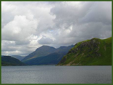
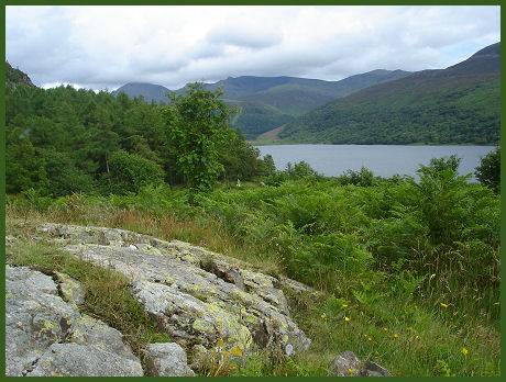
Left - Looking east along Ennerdale Water. Right- View from the north shore near Bowness Knott
The River Liza ((Lysa in Norse means bright water) flows down from Great Gable, through the Liza Valley, and empties into the lake. Great Gable's northern crags face down the valley, next to Kirk Fell.
Ennerdale Forest is one of the largest in Cumbria, and is rarely busy. Roe deer can occasionally be seen, the best time to spot them is at either dawn and dusk. Red Squirrel also inhabit the valley and may be seen especially around the Gillerthwaite area. Ennerdale is also home to a wide variety of birds including Peregrine falcon, Raven, Buzzard, Kestrel and Heron.
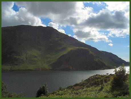
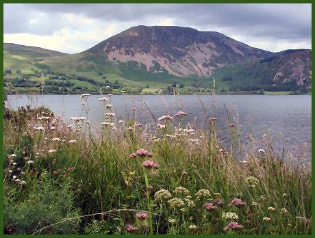
Great Borne seen across Ennerdale Water
Objections were raised when the Forestry Commission planted the extremely straight and unnatural lines of Ennerdale Forest around the lake in the 1930's. Since then the Commision have agreed not to continue this policy within the Lake District National Park. The forest offers a number of attractive walks. Maps are available from self service boxes at the Bowness Knott car park.
Ennerdale Wildlife
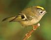 The Ennerdale area is inhabited by one of the smallest birds in Europe, the Goldcrest (Regulus regulus). It is only three and a half inches long and as its name suggests its head bears a gold crest,
The black-bordered crest stripe is orange in the male and yellow in the female, the body is olive green above and creamy-white below, their song is particularly high-pitched. Nesting commences in late April. The bird is, however, seldom seen as it spends most of its time in the high treetops.
The Ennerdale area is inhabited by one of the smallest birds in Europe, the Goldcrest (Regulus regulus). It is only three and a half inches long and as its name suggests its head bears a gold crest,
The black-bordered crest stripe is orange in the male and yellow in the female, the body is olive green above and creamy-white below, their song is particularly high-pitched. Nesting commences in late April. The bird is, however, seldom seen as it spends most of its time in the high treetops.
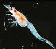 Ennerdale Water hosts a relic of the ice age within its depths, a freshwater shrimp named Mysis Relicta, otherwise known as the opossum shrimp, the shrimp was
trapped there during the last glacial period. It is rarely if ever observed, as it feeds during the night and spends the day hiding in the depths of the lake.
Ennerdale Water hosts a relic of the ice age within its depths, a freshwater shrimp named Mysis Relicta, otherwise known as the opossum shrimp, the shrimp was
trapped there during the last glacial period. It is rarely if ever observed, as it feeds during the night and spends the day hiding in the depths of the lake.
The quiet village of Ennerdale Bridge stands on the boundary of the National Park, about a mile to the west of the lake and ten miles from Cockermouth. St Mary’s church, in the village, which dates from 1856-58, occupies the site of an earlier, medieval chapel. Wordsworth mentions Ennerdale Bridge in 'The Brothers', which was set in the village churchyard. There are two pubs, one of which offers overnight accommodation. The annual Ennerdale Show is held during the last week in August, and features agricultural displays, competitions, arts and crafts.