Rannerdale
OS grid ref:- NY1718
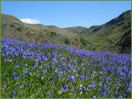
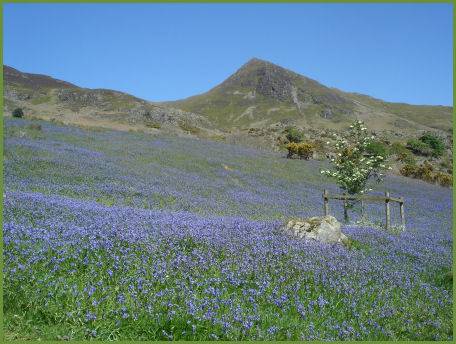
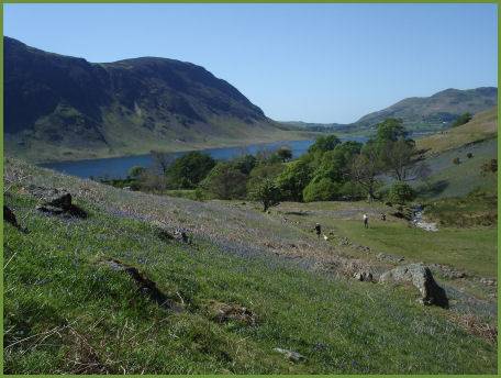
Rannerdale is famous for its glorious spring carpet of bluebells. Rannerdale Knotts at 1160ft, can be accessed from Buttermere village, its summit offers superb views of Crummock Water, Buttermere and the surrounding fells.
The Rannerdale Bluebells
Sometimes referred to as the 'Secret Valley', this area is said to be the site of a battle at which native Cumbrians and Norsemen ambushed and defeated Norman armies in the century after they conquered England in 1066. Local historian and publican Nicholas Size published a historical novel about Cumbric resistance to the Norman invaders in 1930 called 'The Secret Valley'.
Buttermere from Rannerdale and Grasmoor from Rannerdale
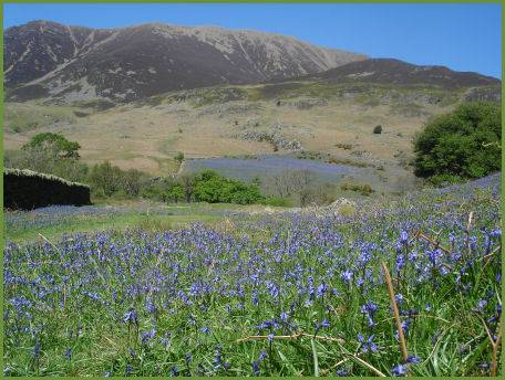
Bluebells flower in profusion in this valley in April and May, local folklore states they sprung from the spilt blood of the slain Norman warriors. A Norman army under the command of Ranulph les Meschines, Earl of Carlisle, advanced south from Cockermouth, the Cumbrians were under the command of Earl Boethar, who succeeded in drawing the Normans into the side valley of Rannerdale, then routed them with a surprise attack from above and behind.
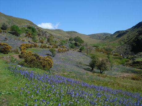
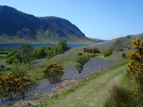
Rannerdales bluebells are renowned as a natural wonder, beloved of visitors and photographers; however, they are being loved to death. Once the plants are damaged by trampling they cant photosynthesise enough energy and it can take them years to recover. Over the last 5 years, nearly 25% of the bluebells have been lost. To save the bluebells, and access to them, the National Trust are asking visitors to fight the urge to get in amongst the flowers and just simply stick to the path. Only by protecting them today can we ensure everyone has a chance to enjoy this special spring display in the future.
A walk at Rannerdale
 Distance :- four and a half miles (7.2km)
Duration :- 3 hours
*Commencing at the roadside parking area at Cinderdale Common, beneath Grasmoor, walk up beside Cinderdale Beck for around 50 yards (46m) cross the beck, following the broad track leading up to Rannerdale Knotts.
*As the path reaches the entrance to Rannerdale, cross the footbridge over Squat Beck, turn left to a gate and take the path which rises up to Rannerdale.
*Continue on the path to the highest point of the dale, from where excellent views of Robinson unfold.
*Turn right at the top of the dale to the path that runs along the top of a ridge. The route down keeps initially to the right of the top of the Knotts, it reaches a low col between the main summit and a minor peak lower down. Turn left here and descend into a rocky gully.
*Turn left at the bottom of the gully, then right through bracken, descending to Hause Point. When the road is reached, turn right and then turn and cross a parking area. Follow the wall and then turn into the entrance to Rannerdale. Recross the bridge over Squat Beck and retrace your route to Cinderdale Common.