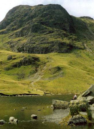
Stickle Tarn
OS Grid Ref:- NY288078
Stickle Tarn lies in a dramatic location below the steep eastern face of Harrison Stickle (2,403 feet), the tarn is a waterfilled corrie lying at an elevation of 473 metres (1552 feet) and has a depth of around 50 feet. The tarn was enlarged by the building of a stone dam in 1838 for the Gunpowder works at Elterwater.
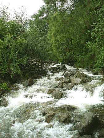
Left- Stickle Tarn and Harrison Stickle Right - Stickle Ghyll
The walk up to Stickle Tarn, from where there are excellent views of the Langdale Valley and across to Windermere, takes about an hour and although steep can be managed by most walkers.
The route to Harrison Stickle
The climb to Harrison Stickle at 2,414 feet is relatively easy. Ample car parking is provided at the National Trust car park. At the Dungeon Ghyll Hotel follow the path up the hillside which leads from the back of the hotel, taking the left fork to Stickle Ghyll which climbs up to bleak Stickle Tarn.
The view from Stickle Tarn
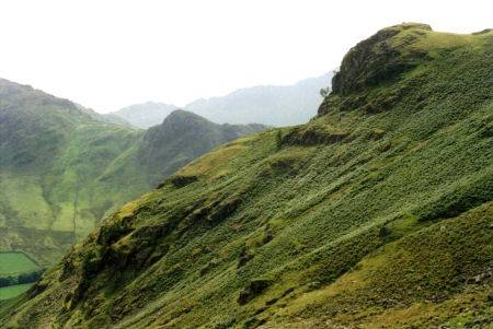
At Stickle Tarn cross the ghyll via the stepping stones and follow the path along the south-east shore of the tarn. At the end of the Stickle Tarn the path heads north and crosses a stream before heading northwest behind Pavey Ark.
Take the direct route up North Rake climbing to the summit, the path then heads south west to Harrison Stickle, from where there are excellent views of Great Langdale and Lake Windermere beyond.
Back to Top