The Old Man of Coniston
OS Grid ref:- SD 27237
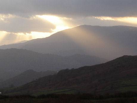 The Old Man of Coniston, which forms the highest point in the Furness Fells, rises
to 803 metres (2,635 feet) towering dramatically over Coniston village, it is one of Lakeland's most famous peaks.
The Old Man of Coniston, which forms the highest point in the Furness Fells, rises
to 803 metres (2,635 feet) towering dramatically over Coniston village, it is one of Lakeland's most famous peaks.
The fell's summit offers superb views taking in much of the southern Lake District, Morecambe Bay, Blackpool Tower, and the Isle of Man. The ascent to the Old Man of Coniston usually begins at Coniston village via Church Beck and the mines and takes around five hours. Alternatives ascents are the south ridge and the path to Goat's Water, both climbing from the Walna Scar Road. The Walna Scar Road can also be accessed from Torver, or from Seathwaite in the Duddon Valley. So famous has the route from Coniston Village become that the sheep along the route have become very accustomed to walkers and apparently show no fear of them. They have been known to snatch sandwiches and other foodstuffs from rucksacks!
The Furness Fells commence in the north at the Wrynose Pass and continue south for a length of around ten miles before petering out at Broughton in Furness on the Duddon Estuary.
Low Water, a corrie tarn, lies beneath the northern face of The Old Man. The tarn was once dammed in order to provide water for the quarries, but its waters now flow out along a cascade of falls into the Coppermines Valley
Coniston's copper mines are among the largest in Britain. The flanks of the Old Man were the scene of much industrial exploitation in the past, firstly for copper and later on slate quarrying. Mining in the area, on a small scale, began in Roman times, the area became widely used for copper mining from the seventeenth century. Those activities have left their scars on the face of the mountain.
A walk to the summit of the Old Man of Coniston
 * Commencing at the petrol station on the south side of Coniston village, proceed up the steep road opposite. Turn left on reaching the grass covered reservoir and following the signs to Walna Scar Road.
At the top of the road a green lane (Walna Scar road) begins at the car park. Continue straight on along this lane.
* Commencing at the petrol station on the south side of Coniston village, proceed up the steep road opposite. Turn left on reaching the grass covered reservoir and following the signs to Walna Scar Road.
At the top of the road a green lane (Walna Scar road) begins at the car park. Continue straight on along this lane.*Pass through a gate and continue until reaching a right fork with steps leading up to a path. Head towards Dow Crag, past the old quarry, over a ridge, then down to Goat's Water tarn.
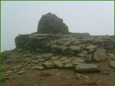
*Continue along the path from Goat's Water up to the col of Goat's Hause. Upon reaching level ground at the top of the pass turn right to reach the summit of the Old Man.
*The route back follows the zigzag path towards Low Water, after arriving at Low Water turn right, heading in the direction of Coniston Water, passing through the old mine workings, turn right to reach the car park previously passed through. Remain on the path, ignore a side path on the left and continue to the following junction, at which point take the left fork.
*Pass through a gate and head towards the cottages. The route now follows the course of Levers Water Beck leading towards a further wall. Pass through a further gate and pass the waterfall. Pass, but do not cross the Miners Bridge and continue on with the back to your left. Go through a further two gates, the second of these gates opens onto onto a road in the starting point of Coniston village.