Loughrigg Fell
OS Grid ref:- NY347051
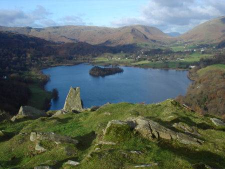
Loughrigg Fell stands on the end of the long ridge coming down from High Raise over Silver How towards Ambleside, and is separated from its neighbours by the depression of Red Bank. The fell rises to a height of 335 metres (1,099 feet) and offers excellent views of Grasmere and the Langdale Pikes.
Grasmere from Loughrigg Fell
. To the north of Loughrigg Fell the River Rothay flows through Grasmere and Rydal Water before bending around the eastern side of Loughrigg. On the southern side the Brathay runs from Elterwater and is also fed by the outfall from Loughrigg Tarn , the tarn lies below the south west corner of the fell.
The fell is easily accessible, being fairlly well surrounded by roads. There are many paths which traverse it, including Loughrigg Terrace, a footpath which offers superb views of Grasmere, Helm Crag and the Fairfield group. Todd Crag at the eastern end of the fell provides a good view of Galava Roman Fort at Ambleside, on the shores of lake Windermere. Just beyond the eastern end of the Terrace are some caves, formed as a result of quarrying, there are other small mines on the fell.